
Another Round of Colder, Snowy Weather Heading Into The Weekend
Would you rather have have the colder, snowy days on the weekend or during the week? It would make it easier to sit through the AFC Championship game with the temps in the 40's-50's!
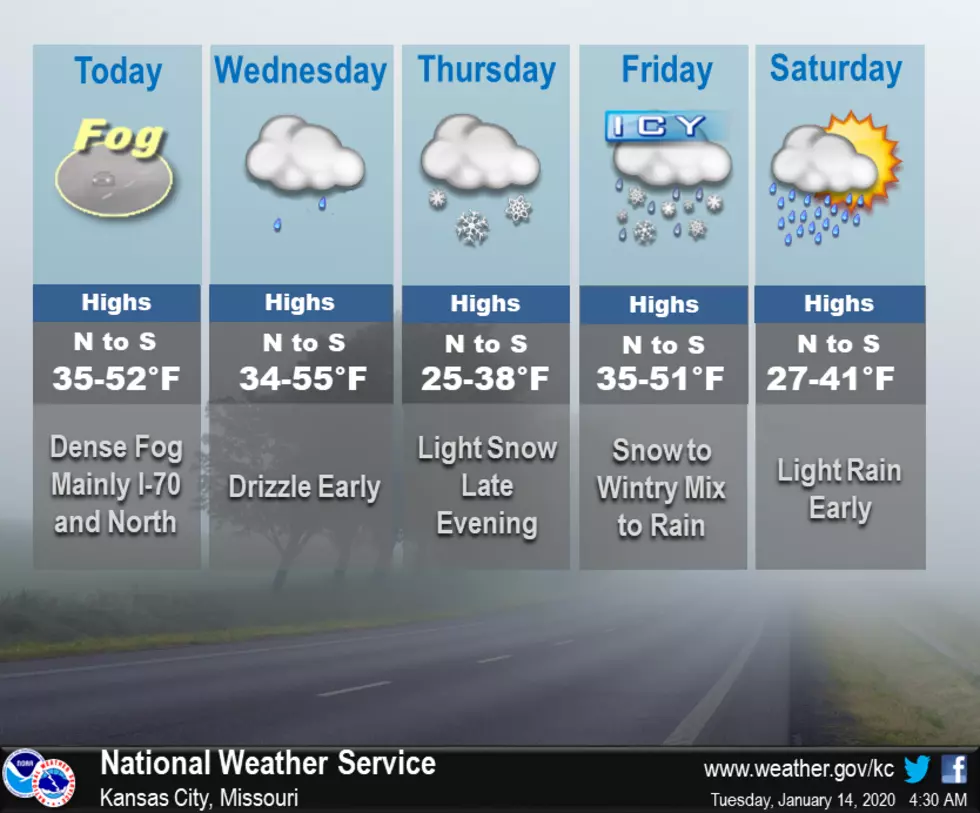
Dense fog could be another issue this morning, mainly along and north of I-70, so it might be a good idea to allow some extra time for your morning commute. Winter weather will return to the area Thursday night into the early afternoon Friday. Expect precipitation to start out as snow with a transition to a wintry mix Friday morning, followed by all rain by the afternoon. This could cause issues for the Friday morning commute, but more details will be available as we near the end of the week.
Here's the forecast the Sedalia/Warrensburg area according to the National Weather Service:
TodayPatchy fog before 10am. Otherwise, partly sunny, with a high near 48. Southwest wind around 6 mph becoming light and variable.TonightA slight chance of drizzle after 3am. Mostly cloudy, with a low around 42. East southeast wind 6 to 9 mph becoming south southwest after midnight.WednesdayPartly sunny, with a temperature falling to around 38 by 5pm. Southwest wind 9 to 15 mph becoming north northwest in the afternoon. Winds could gust as high as 22 mph.Wednesday NightPartly cloudy, with a low around 19. North wind 7 to 10 mph.ThursdayPartly sunny, with a high near 35. Northeast wind around 8 mph.Thursday NightSnow likely, mainly after midnight. Cloudy, with a low around 28. Chance of precipitation is 70%.FridaySnow before 8am, then snow, possibly mixed with sleet between 8am and 9am, then rain after 9am. High near 46. Chance of precipitation is 90%.Friday NightRain, mainly before midnight. Low around 32. Chance of precipitation is 90%.SaturdayMostly sunny, with a high near 38.Saturday NightPartly cloudy, with a low around 18.SundayPartly sunny, with a high near 33.Sunday NightMostly cloudy, with a low around 18.M.L.King DayPartly sunny, with a high near 32.

More From Mix 92.3


