Finally…Some Relief From The Heat!
Traveling up to Kansas City and back yesterday was actually a pleasant experience as temperatures held in the upper 70' to the low 80's. It looks like we can experience some more great weather this week in our area.
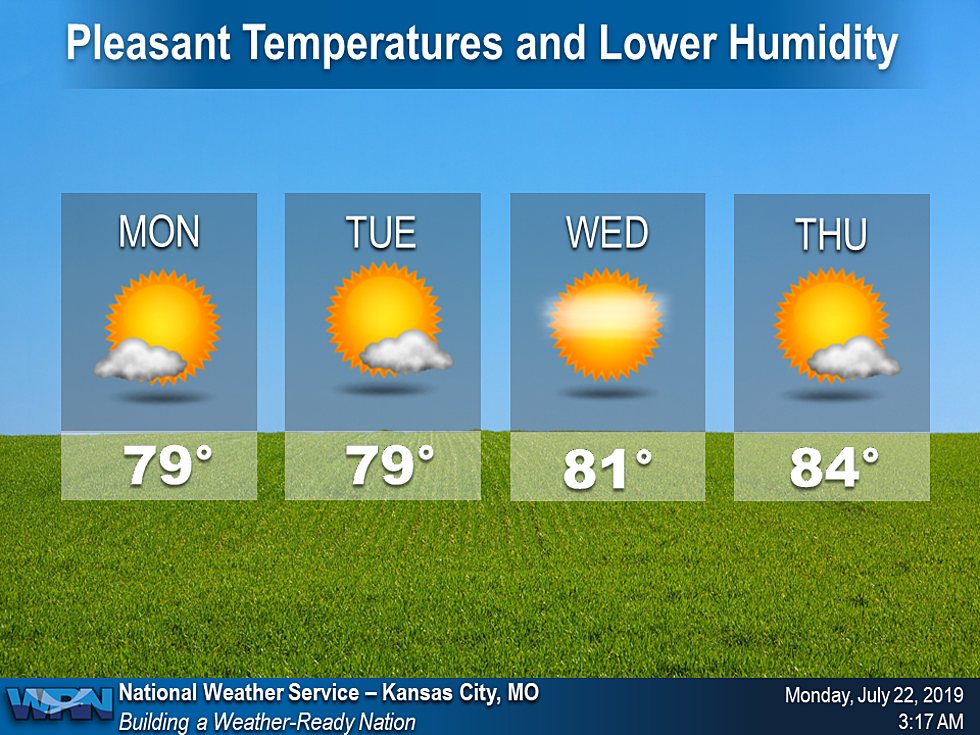
According to the National Weather Service:
The cold front that brought storms to the area yesterday has moved through ushering in much more pleasant temperatures and lower humidity. High pressure will move into the area tonight and remain over the area through most of the week keeping cooler and less humid conditions over the area under mostly sunny skies. Enjoy!
The forecast for Monday thru Friday sounds fantastic!
MondayA chance of showers and thunderstorms, mainly before 9am. Cloudy through mid morning, then gradual clearing, with a high near 79. North wind 9 to 13 mph. Chance of precipitation is 40%. New precipitation amounts of less than a tenth of an inch, except higher amounts possible in thunderstorms.Monday NightMostly clear, with a low around 59. North wind 5 to 10 mph becoming light after midnight.TuesdaySunny, with a high near 78. North wind 3 to 8 mph.Tuesday NightPatchy fog after 5am. Otherwise, mostly clear, with a low around 58. Light north wind.WednesdaySunny, with a high near 81.Wednesday NightMostly clear, with a low around 60.ThursdaySunny, with a high near 82.Thursday NightMostly clear, with a low around 63.FridaySunny, with a high near 84.

More From Mix 92.3